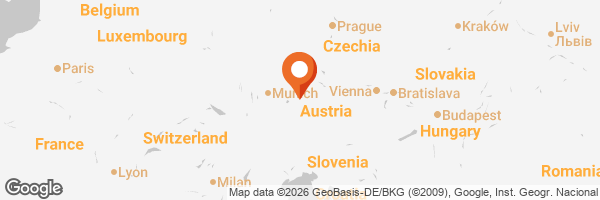
It was such an exciting moment for me to finally see the Austrian Alps up close and in reality. Until then, I had only seen these magnificent mountains from an airplane while flying to different travel destinations. During my three-week physiotherapy stay in Gastein, Salzburg, I decided to make the most of one of my free wellness days and take a trip up to Stubnerkogel.
Luckily, my chalet was located right next to the Stubnerkogel Lift, which was perfect for me as I was suffering from a slight heel spur and wanted to avoid too much walking. I also discovered that booking my round-trip lift ticket online was cheaper than purchasing it directly at the station counter—another little bonus that made the trip even better!
Stubnerkogel
According to the information/Legend presented on the top station, Stubnerkogel is 2251 meters high and said to be the most scenic mountain imaginable. One can also see the whole chart and each description of the peaks and the name of the area they are located in. It was extremely amazing to reach the top. From there, the mountains seem endless and so breathtaking, because you see so many peaks that each have different characteristics.
From the top of a platform, on a clear day, one can see the Großglockner (3798 meters high), the highest mountain in Austria. The Gastein Valley is far below, and when seen from the top of Stubnerkogel, it appears like a miniature village surrounded by the enormous mountain landscape.


Es war für mich ein ganz besonderer und aufregender Moment, die österreichischen Alpen endlich aus nächster Nähe und in Wirklichkeit zu sehen. Bis dahin hatte ich diese beeindruckenden Berge nur aus dem Flugzeug gesehen, wenn ich zu verschiedenen Reisezielen unterwegs war. Während meines dreiwöchigen Physiotherapieaufenthalts in Gastein, Salzburg, beschloss ich, einen meiner freien Wellnesstage zu nutzen und einen Ausflug auf den Stubnerkogel zu machen.
Zum Glück lag mein Chalet direkt neben der Stubnerkogelbahn, was für mich ideal war, da ich unter einem leichten Fersensporn litt und längere Fußwege vermeiden wollte. Außerdem entdeckte ich, dass die Online-Buchung der Hin- und Rückfahrt mit der Seilbahn günstiger war als der Kauf direkt an der Kasse – ein weiterer kleiner Bonus, der meinen Ausflug noch schöner machte!
Stubnerkogel
Den Informationen bzw. der Legende zufolge, die an der Bergstation ausgestellt sind, ist der Stubnerkogel 2.251 Meter hoch und gilt als der landschaftlich reizvollste Berg, den man sich vorstellen kann. Man kann auch die gesamte Karte einsehen, zusammen mit Beschreibungen der einzelnen Gipfel und den Namen der Gebiete, in denen sie sich befinden. Der Aufstieg zum Gipfel war ein unglaubliches Erlebnis. Von dort aus wirken die Berge endlos und absolut atemberaubend, da man so viele Gipfel sehen kann, von denen jeder seine ganz eigenen Merkmale aufweist.
Von der Aussichtsplattform aus kann man an klaren Tagen den Großglockner (3.798 Meter hoch), den höchsten Berg Österreichs, sehen. Das Gasteinertal liegt weit unter einem und wirkt vom Gipfel des Stubnerkogels aus wie ein Miniaturdorf, umgeben von der weiten Berglandschaft.


 )
)

Stubnergipfelkreuz (below Photo)
This is a cross on the higher level and it´s called Stubnerkogel Gipfelkreuz; it´s iconic, and it stands proudly at 2246 meters above sea level.

Stubnergipfelkreuz
Dies ist ein Kreuz auf der höheren Ebene, das „Stubnerkogel-Gipfelkreuz“ genannt wird; es ist ein Wahrzeichen und thront stolz auf 2.246 Metern über dem Meeresspiegel.

Suspension Bridge
A few steps down from the Gipfelkreuz is the Suspension Bridge that is 140 meters long. I tried it, and it was a nerve-tingling experience because it is moving, so I guess it is not for those who have weak knees. The end of the suspension Bridge led me to the conveniently located restaurant.
Hängebrücke
Ein paar Stufen unterhalb des Gipfelkreuzes befindet sich die 140 Meter lange Hängebrücke. Ich habe sie ausprobiert, und es war ein nervenaufreibendes Erlebnis, da sie sich bewegt – für Leute mit schwachen Knien ist sie also wohl nichts. Am Ende der Hängebrücke gelangte ich zu dem günstig gelegenen Restaurant.

After my walk, I was feeling hungry, so it was time to eat lunch before going downhill. It was the best goulash soup I had eaten in a long time. With a glass of beer, everything is perfect!
Nach meinem Spaziergang hatte ich Hunger, also war es Zeit für ein Mittagessen, bevor es bergab ging. Es war die beste Gulaschsuppe, die ich seit langem gegessen habe. Mit einem Glas Bier ist einfach alles perfekt!


A hiking trail for everyone/ Ein Wanderweg für jedermann.


The lift downhill is just next to the restaurant. It had been a very successful day experiencing the amazing panoramic view of the Alps, especially the photo of the snow-covered peaks of the Hohe Tauern Alps.
Der Lift bergab befindet sich direkt neben dem Restaurant. Es war ein sehr gelungener Tag, an dem wir den atemberaubenden Panoramablick auf die Alpen genießen konnten, insbesondere das Foto der schneebedeckten Gipfel der Hohen Tauern.

You might like to see my other posts on Gastein and Salzburg below:
https://peakd.com/hive-163772/@mers/a-refreshing-stay-in-badgastein-salzburg-eng-ger https://peakd.com/hive-163772/@mers/the-charming-spa-town-of-bad-hofgastein-salzburg-eng-ger https://peakd.com/hive-163772/@mers/salzburg-in-a-day-eng-ger
Thanks for reading! Mers

GIF by @gremayo, all photos are by @mers